Following Florida Avenue: The Original Boundary of the City of Washington
The 1791 L'Enfant Plan of the City of Washington, DC, shows a tidy and intricate grid of streets and diagonal avenues, with squares, rectangles, and circles at many of the major intersections. The green space of the future National Mall and President's Park is also visible. The plan, which is centered between the Potomac River and Eastern Branch (Anacostia River), narrows as the two waterways meet at Greenleaf's Point, the future home of the Washington Arsenal and, later, Fort McNair. The plan is so significant to Washington and the nation's history that it was officially designated and added to the National Register of Historic Places in 1997.
Despite its detail, the plan ends abruptly, with a lot of blank space on the map. Nothing is shown west of the Potomac, part of the District until 1847, or east of the Anacostia. Georgetown, a separate city with its own government, is shown with limited detail, and north of Georgetown and the proposed City of Washington is more blank space.
The vast area outside of the City of Washington and Georgetown became Washington County, a rural landscape of farms, estates, and plantations. Throughout much of the 19th century there was a boundary between the City of Washington and the areas to the west, north, and east. In fact, there was even a Boundary Street (today's Florida Avenue). The three jurisdictions would finally consolidate following the Organic Act of 1871. This tour traces that northern boundary and the many historic landmarks and districts that can be found along its path. Many important buildings and structures have been constructed along this boundary, in a variety of architectural styles, and the adjacent landmarks and districts have witnessed important social history, which is both locally and nationally significant.
The original boundary starts on the west end, where Rock Creek meets the Potomac. Here, west of Rock Creek, is Georgetown. Therefore, this was a natural boundary marker for L'Enfant as he sketched out his plan. Just north of the river is the start of the Chesapeake & Ohio Canal, a critical transportation link to Cumberland, Maryland and points farther west.
As Rock Creek winds slightly to the east, the boundary does as well. At roughly 22nd Street, 23rd Street, and Massachusetts Avenue NW, the boundary breaks from Rock Creek and moves to the northeast. Here, L'Enfant followed another natural boundary marker, the escarpment. Washingtonians have likely noticed this escarpment, or slope, as the elevation increases north of Florida Avenue, particularly between Connecticut and Sherman avenues. North of here the District's topography becomes more varied and challenging, especially for 18th century transportation. Therefore, this was a natural end point for the L'Enfant Plan.
Florida Avenue (Boundary Street) continues northeast past Meridian Hill Park and Cardozo Senior High School before abruptly turning south between 11th and 9th streets NW. The boundary then goes in a southeast direction until 15th Street NE. This southeast diagonal is apparent to anyone traveling up or down Florida Avenue between U Street and Benning Road. This stretch also includes many historic neighborhoods, including LeDroit Park and Bloomingdale, as well as Union Market and Gallaudet University. LeDroit Park is particularly significant, as this "suburb" was built just north of the city, starting in the 1870s. It was new residential subdivisions like this — which did not conform to the L'Enfant Plan — that prompted Congress to pass the Subdivision Act of 1888 and then the Permanent Highway Act of 1893. Because of these laws, many of the neighborhoods developed in the former Washington County have an orderly grid, intersected with grand avenues and circles (e.g., Petworth's Grant and Sherman circles) — although, many streets ended up being platted with some respect to the topography. Following pushback, subdivisions platted prior to the law's passage were incorporated into the new street layout and their somewhat haphazard street layout can still be seen today (e.g., Columbia Heights and Mount Pleasant).
Also in the 1890s, Boundary Street officially became Florida Avenue — further illustrating the desire to continue the L'Enfant Plan northward. This also explains Florida Avenue's unique path as it twists and turns around the city.
The boundary then moves south along 15th Street NE, before turning eastward along C Street NE. When looking at the L'Enfant Plan, the northern boundary ends without fanfare — no major avenue, circle or square — at the Anacostia River, another natural boundary marker. Today, this area is known as Kingman Park and is just north of the former RFK Stadium.
Today, the boundary is not officially marked, but there are many reminders of it as Washingtonians move through the city, whether exercising along the District's waterways or commuting along Florida Avenue. This tour seeks to highlight this significant history and the important historic sites found along this pathway.
Sites 28
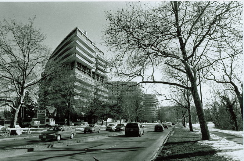
Watergate Complex: Beyond its iconic and unusual architecture, the Watergate is best known for the scandal named for it.
Recognized internationally for its name, which has even entered the popular lexicon as shorthand for a scandal, the luxury Watergate Complex is a Washington icon. Located on the banks of the Potomac,…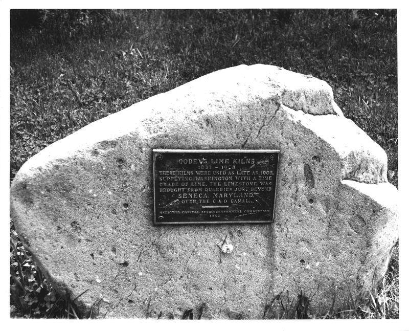
Godey Lime Kilns (Washington Lime Kilns): The Godey Lime Kilns, built in 1864, are the remains of a manufacturing business established by William H. Godey.
The Godey Lime Kilns were an important part of the thriving mid-19th-century commercial life of Georgetown. The manufacture and sale of lime at this site was conducted from 1864 to 1907, but the lime…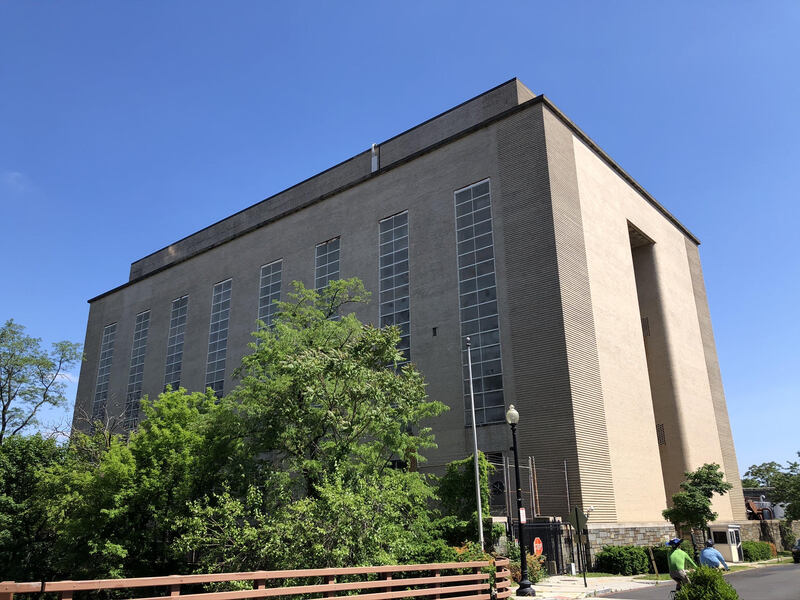
West Heating Plant: The West Heating Plant, completed in 1948, was designed by W.M. Dewey Foster to generate steam for nearby federal buildings.
The West Heating Plant, originally known as the West Central Heating Plant, was designed by consulting architect William Dewey Foster (1890-1958), working under successive Supervising Architects of…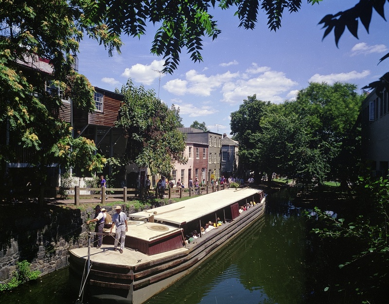
C&O Canal National Historical Park: The Chesapeake and Ohio Canal is an excellent and well-preserved example of 19th-century canal technology.
The C&O Canal Company was chartered in 1825, the same year as the opening of the Erie Canal. The groundbreaking was celebrated by President John Quincy Adams at Little Falls in 1828. The canal was…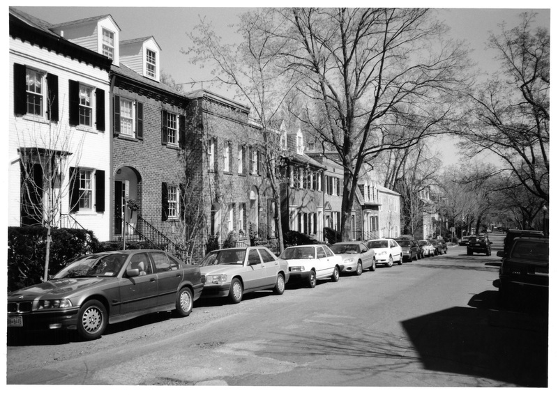
Georgetown Historic District: One of DC's oldest neighborhoods, Georgetown Historic District encompasses a complete historic town, and was the District's first designated historic district.
Georgetown was founded by an Act of the Maryland Assembly in 1751 and incorporated with an elected government in 1789. It became part of the District of Columbia upon its establishment in 1791,…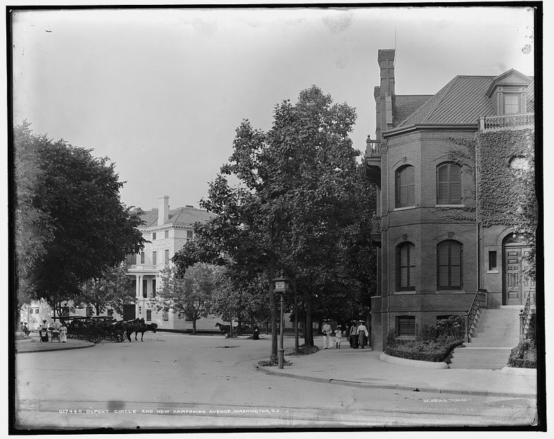
Dupont Circle Historic District: Dupont Circle's rich history is reflected by its diverse and elegant architecture.
The Dupont Circle Historic District encompasses one of the city's most elegant historic residential neighborhoods, notable for superior examples of Victorian rowhouse architecture in Queen Anne and…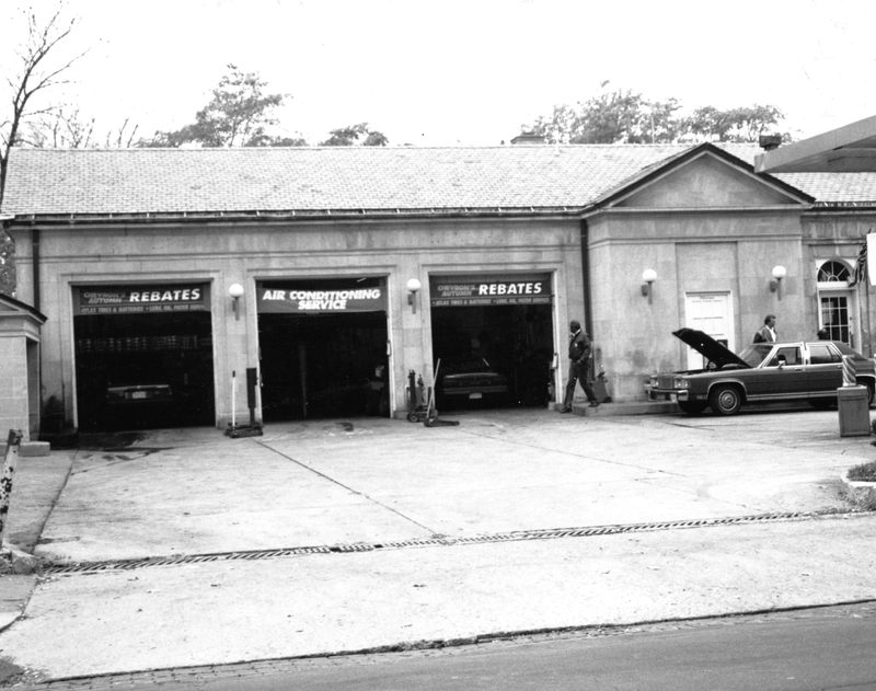
Embassy Gulf Service Station: The Embassy Gulf Service Station is an important and intact example of 1930s gas station architecture in DC.
The Embassy Gulf Service Station is a notable example of the 1930s gas station architecture, illustrative of efforts to produce more attractive gas stations that enhanced rather than detracted from…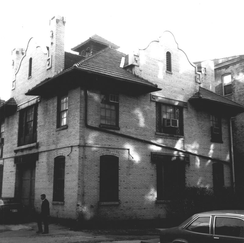
Walsh Stables: This stable marks the last gasp of horse-drawn transportation for DC's wealthy in the pre-automobile era.
Built for "gold king" Thomas F. Walsh, this stable was an adjunct to the nearby Walsh Mansion at 2020 Massachusetts Avenue NW. Walsh (1851-1910) immigrated to the United States from Ireland and…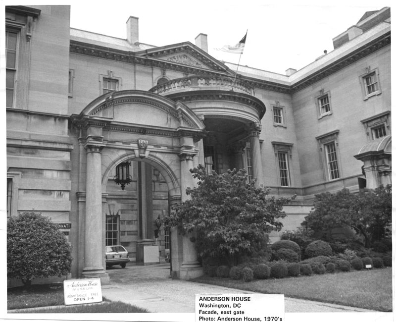
Larz Anderson House (Society of the Cincinnati): Originally commissioned for lavish entertaining, this limestone edifice from 1902-05 was one of the largest and costliest private homes in the city.
Built for diplomat Larz Anderson and his wife Isabel Weld Perkins Anderson, an author, philanthropist, and heiress to a trading fortune, the Anderson House also served as the temporary residence of…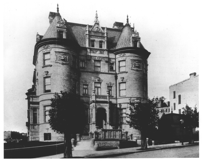
Massachusetts Avenue Historic District: The Massachusetts Avenue Historic District's grandly appointed buildings are widely known as Embassy Row.
Massachusetts Avenue is a boulevard of grand mansions, row houses, and embassies, affectionately known as "Embassy Row." It is among the finest realizations of L'Enfant's Baroque vision of grand…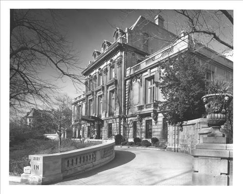
Richard H. Townsend House (Cosmos Club): This grand mansion has long been at the center of Washington's high society.
The Townsend House is one of the many elegant and often ostentatious mansions built along Massachusetts Avenue in the early decades of the 20th century. Completed in 1900 for Richard H. Townsend, a…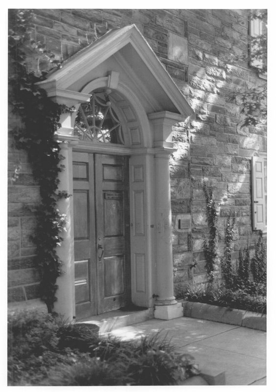
Friends Meeting House (Friends Meeting of Washington): This meeting house provided services for the first Quaker elected President, Herbert Hoover.
Built in 1930 and designed by Walter F. Price, the Washington Friends Meeting House is a Colonial Revival building decorated with Georgian elements, such as quoins and keystones, and Federal elements,…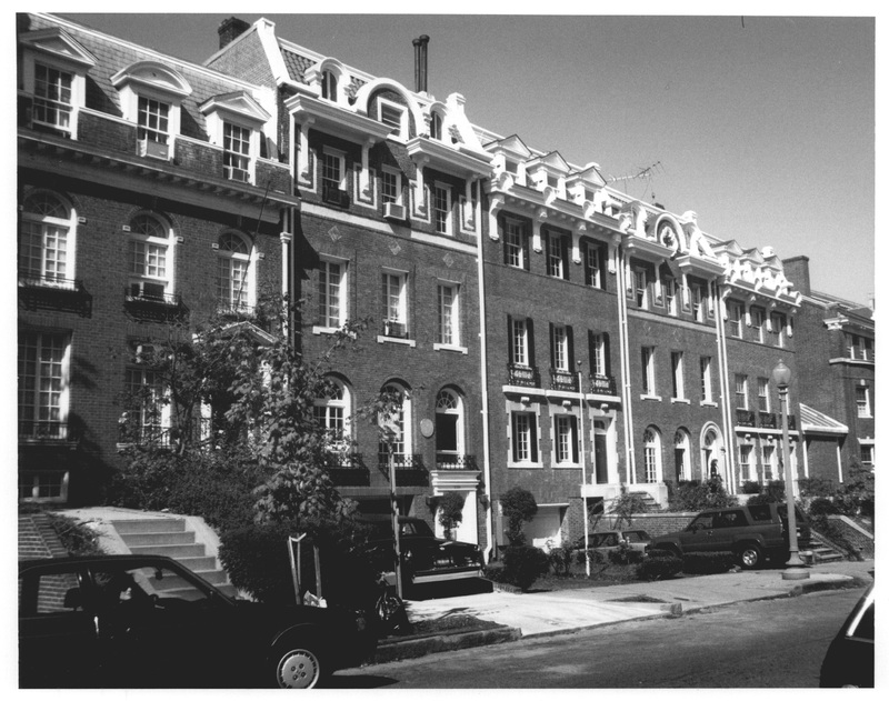
Sheridan-Kalorama Historic District: The town-like landscape of Sheridan-Kalorama exemplifies the development that took place outside of DC's urban center as many sought a more suburban lifestyle.
Known in the 19th century for its idyllic landscape, the area now known as Sheridan-Kalorama underwent rapid development in the early 20th century as the city's growing population moved away from the…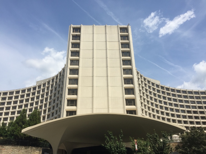
Washington Hilton: This hotel between Dupont Circle and Adams Morgan was the site of the 1981 assassination attempt on President Reagan.
Constructed in 1962-65, the Washington Hilton was hailed for its sinuous massing, its use of column-and-slab construction throughout, and its uniform precast concrete wall panels—in sum, a sharp…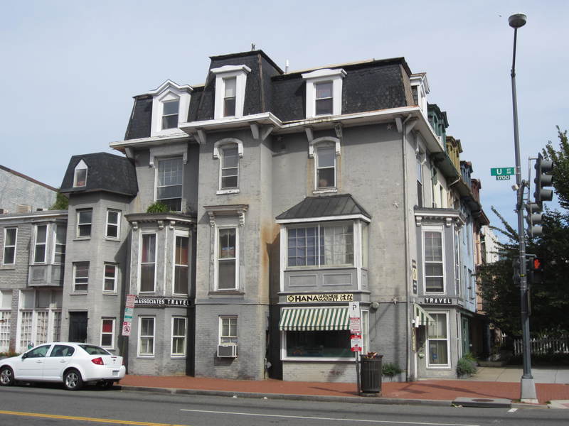
Strivers’ Section Historic District: This historic district is notable for its ties to DC's African American community, especially as the home of the city's early Black middle class.
Strivers' Section is a predominantly residential area with longstanding associations with leading individuals and institutions in Washington's African American community. It is characterized by late…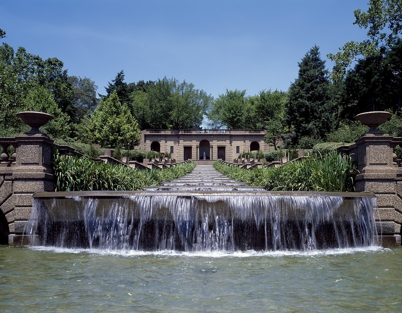
Meridian Hill Park (Malcolm X Park): This historic designed landscape stretches between the neighborhoods of Columbia Heights and Adams Morgan.
Meridian Hill Park, also known today as Malcolm X Park following a 1969 speech by activist Angela Davis, is a distinguished example of landscape design. The hilly, twelve-acre park with its Beaux-Arts…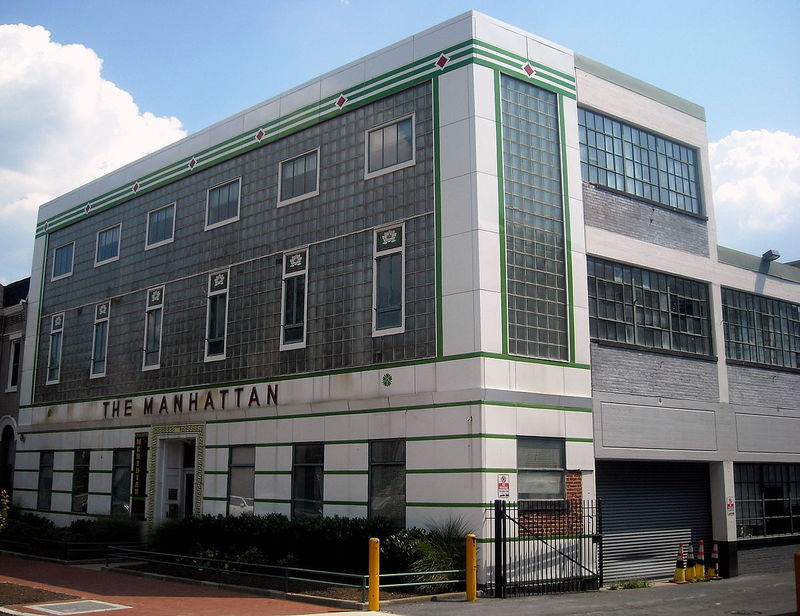
Manhattan Laundry: The three buildings that comprise the Manhattan Laundry reflect six decades' worth of architecture and history in DC.
The property known as the Manhattan Laundry includes three separate buildings connected by two different enclosed bridges, the oldest of which was built in 1877 and the newest in 1936. In addition to…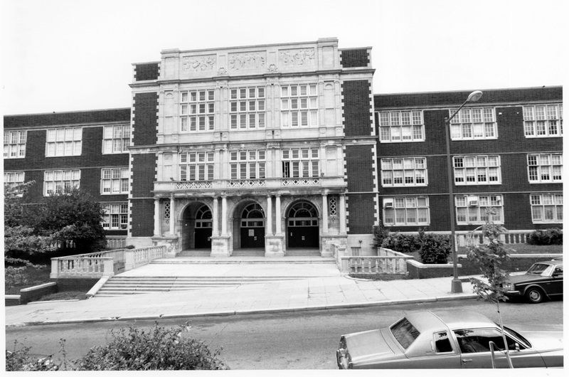
Central High School (Cardozo Senior High School): The city's largest and most elaborate high school was built 1914-1916 as the successor to Washington High School.
Built between 1914 and 1916, Cardozo High School is the work of William B. Ittner, a nationally prominent school architect from St. Louis. The Elizabethan-style building and athletic facilities were…
Southern Aid Society Building (Dunbar Theater): This mixed-use building once served as a life insurance company and a cinema.
While Black architect Isaiah T. Hatton (1883-1921) designed the building in the Italian Renaissance Revival style, Reginald W. Geare (1889-1927) designed the movie theater on the first floor of the…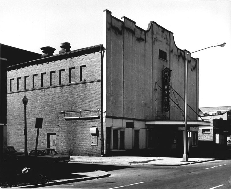
Howard Theatre: Built in 1910, the Howard Theatre remains an important site for Black talent and entertainment.
Built in 1910, the Howard Theatre is one of the oldest theaters in the country that not only served Black audiences but provided a space for Black performers. For more than five decades of the…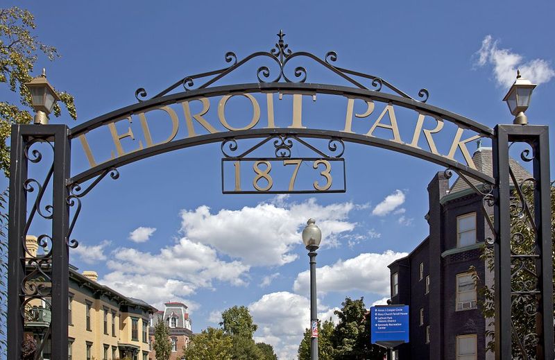
LeDroit Park Historic District: The subdivision of LeDroit Park is located in the northwest sector of the city, to the south of Howard University, and just north of Florida Avenue, the original L'Enfant boundary.
Established in 1873, LeDroit Park represents an important aspect of the development of Washington. It is an early example of a planned, architecturally unified subdivision. This development of…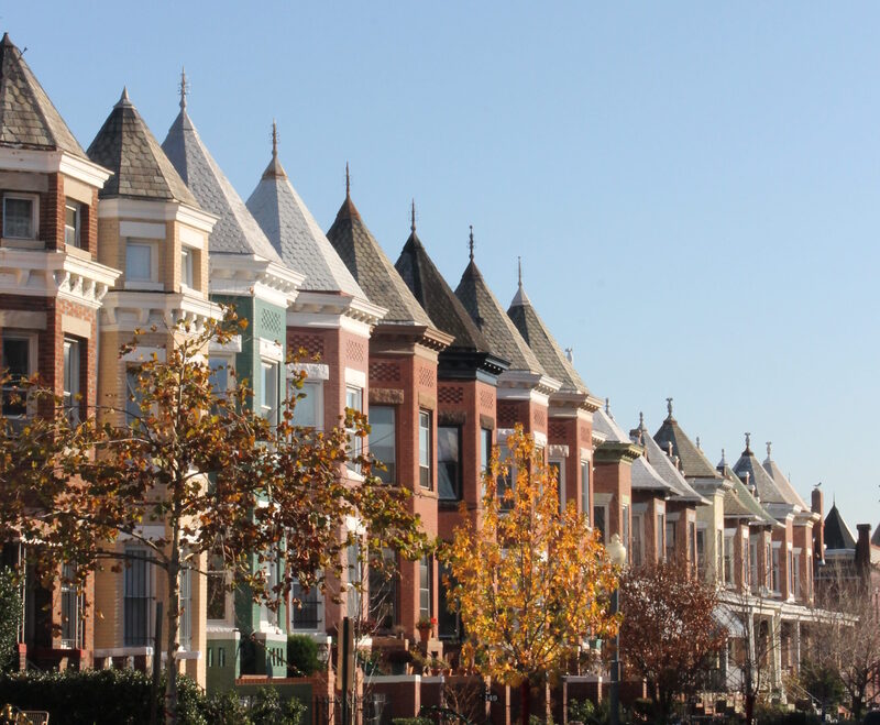
Bloomingdale Historic District: Bloomingdale is significant for its status as one of DC’s largest cohesive row house neighborhoods.
The Bloomingdale Historic District is a group of 1,692 contributing resources bounded by Channing Street to the north; North Capital Street to the east; Florida Avenue to the south; and 2nd Street to…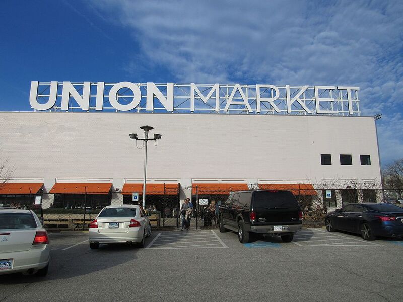
Union Market Historic District: Union Market continues to be a commercial, as well as historic district.
Union Market Terminal is a large complex of wholesale warehouse buildings occupying an approximately forty-acre tract of land located east of Union Station between Florida and New York Avenues…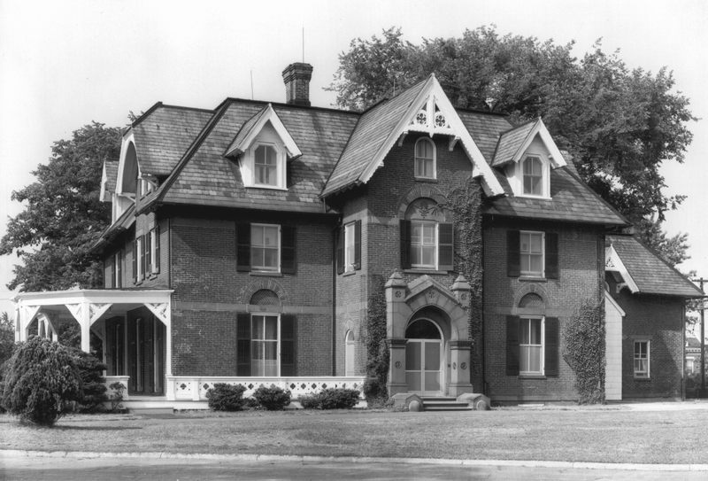
Gallaudet University, President’s House: This large, red brick high Victorian Gothic Revival house is located on a knoll on the Gallaudet campus.
The President's House, erected between 1867 and 1868 and designed by F.C. Withers, is separated from a row of three High Victorian Gothic Revival Professors' Houses by a circular drive and from the…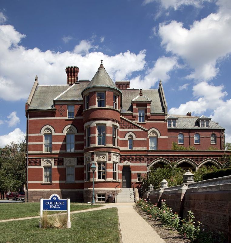
Gallaudet College Historic District: The Gallaudet College Historic District includes most of the original campus of the only university in the U.S. dedicated to the education of the deaf.
Gallaudet University, founded in 1864 as the National Deaf-Mute College, has been since its inception the only institution of higher learning in the United States devoted specifically to the education…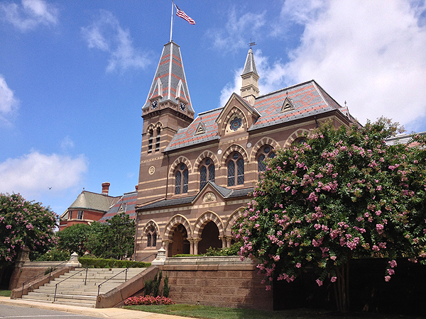
Gallaudet University, Chapel Hall: This original building on the Gallaudet campus was designed as an early symbol of the institution's national importance.
Built in 1870, Chapel Hall was once the main hub of Gallaudet University, serving as a chapel, auditorium, exhibit center, and dining hall. The landscape architecture firm, Olmsted, Vaux & Co.…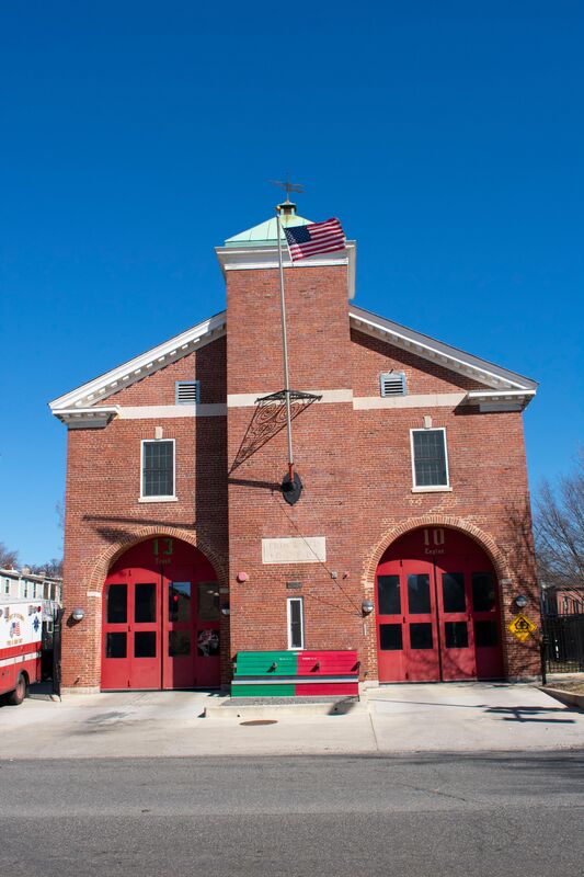
Truck House No. 13 (Engine Company No. 10; Trinidad Firehouse): The design elements of this firehouse, while innovative, were never replicated.
Architecture firm Parks & Baxter designed the Colonial Revival firehouse in 1925, and it still serves as an active fire station today. One of the first firehouses built in DC after World War I, the…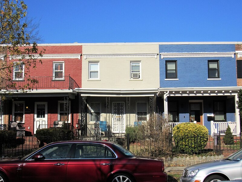
Kingman Park Historic District: Kingman Park fostered an African American community in Northeast DC, while engendering the further growth of segregated residential, educational, and recreational institutions.
The Kingman Park Historic District, located at the northeastern end of today’s Capitol Hill, was principally developed during the late 1920s through 1940s as a residential neighborhood for African…Tour curated by: DC Preservation League